Other Case Studies
The SMART partnership supports improved law enforcement and biological monitoring in protected areas around the world. They came to Refractions to build a software tool to help meet their needs.
Hectares BC – Biodiversity BC on behalf of a broad partnership
Biodiversity BC and its government and non-government partners were looking for regional-level environmental statistics. Refractions proposed a new approach to generating GIS summaries, using the power of a relational database and web tools to provide GIS analysis to users who previously had no access to it.
Automated Route Planning for Meter Reading – City of Vancouver
The City of Vancouver collects water readings from thousands of residences and businesses, but has never optimized the pedestrian routes the readers take. Refractions developed algorithms to create the most efficient routes of the correct length for readers.
Digital Road Atlas – BC Integrated Land Management Bureau
Refractions provides full-service support for the British Columbia Digital Roads Atlas – systems design, maintenance, data conflation, client service, and rapid response.
Caribou Habitat Assessment and Supply Estimator – Wildlife Infometrics Inc.
Refractions converted a legacy habitat modelling system based on ArcView 3.X to ArcGIS 9.2, and automated the workflow to provide faster turnaround time for model runs.
Line Cleaner – BC Ministry of Forests
The British Columbia Ministry of Forests needed a tool to conflate multiple roads databases into a single working layer. Refractions delivered the algorithms and a user interface based on the uDig platform.
Interest Reports – BC Ministry of Agriculture & Lands
Refractions developed an ArcMap extension to automate the calculation of standard reports joining a massive shape-file archive with a large Oracle database.
Mobile GIS – UN Food & Agriculture Organization
UN FAO needed a data collection tool that could run disconnected and didn't have a per-seat licensing cost. Refractions delivered a simple tool using the uDig desktop platform.
Open Web Services, Phase 3 – Open Geospatial Consortium
The Open Geospatial Consortium runs regular “testbed” projects to field-test new concepts in geospatial interoperability. Refractions was a part of the OWS-3 initiative, and built a uDig-based “GeoDSS” client to provide access to several other OGC standard services, including a prototype GeoVideo service.
Natural Language Spatial Search Engine for Rental Places-Rento
Rento is a free web service that makes it easy to find a place to rent in Greece. Powered by PostgreSQL and PostGIS, it provides ad listings with photographs displayed on a map. Searching is accomplished through map navigation and natural language processing, with the search engine being capable of answering complex (spatial) questions such as "flat near the University of Athens" or "loft up to 800 euros near a metro station" (in greek).
Consultative Boundaries Database Viewer – BC Integrated Land Management Bureau
Project Background
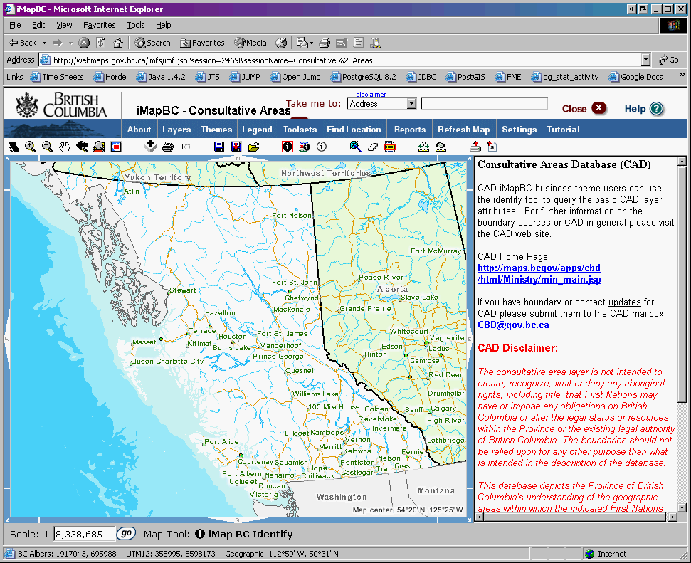
The province of British Columbia is the only jurisdiction in Canada where treaties with the aboriginal inhabitants were never negotiated at the time of European settlements. The legal status of the much of the province is governed by various court judgements that require the government to consult with the local aboriginal organizations before permitting changes to the landscape – such as logging, water diversions, etc.
This “fiduciary obligation to consult” would be relatively manageable, except that there are over 200 different aboriginal organizations in the province, and the areas they must be consulted on are ill-defined. Furthermore, the aboriginal organizations often wish to keep the precise boundaries of their consultation areas private.
Refractions' Solution
Refractions worked together with Bolster Consulting to provide a solution that:
- made the information about what organization to consult with easily accessible;
- made the information about who in the organization to contact easily available;
- allowed location-based queries to determine the exact organizations to contact;
- protected the privacy of aboriginal organizations and the confidentiality of their data.
Bolster Consulting managed the gathering of data from the aboriginal organizations on boundaries for consultation, and appropriate contact information for consulting. Refractions prepared a British Columbia government standard application and data model to publish the information to internal government users:
- An Oracle data model was prepared in Designer;
- An ArcIMS service was created and configured, with custom alterations to the ArcXML;
- An IMF application was set-up to use the ArcIMS layers;
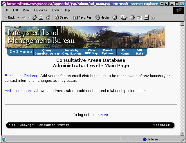
- A custom query interface was built;
- A management interface for updating the information was built.
The “Consultative Boundaries Database” has been online and operational for several years now, and receives continuous use by line Ministry staff to determine points of contact for various applications and land use permits.